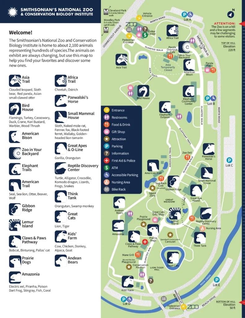
Smithsonian National Zoo Map (2024 – 2021)
Location: Washington, D.C.
Years Active: 1889 – Active
Need a map to navigate the Smithsonian National Zoo? Look no further. Download this Smithsonian National Zoo Map to find them. Short on time? No problem. This map helps you plan the perfect route to see all the must-seens.
Visiting with a group? This map ensures everyone has a fun and memorable experience. Find hidden gems beyond the usual exhibits.
Want to impress your date with your zoo knowledge? This map unveils some of the zoo’s lesser-known treasures.
Get ready for an unforgettable adventure at the National Zoo. This map is your key to unlocking it all.
Smithsonian National Zoo Map 2024
Printable Smithsonian National Zoo Map PDF 2024
Smithsonian National Zoo Map 2023
Printable Smithsonian National Zoo Map PDF 2023
Smithsonian National Zoo Map 2022
Printable Smithsonian National Zoo Map PDF 2022
Smithsonian National Zoo Map 2021
Printable Smithsonian National Zoo Map PDF 2021
FAQ
How long does it take to walk around Smithsonian zoo?
It typically takes 2-3 hours to walk around the Smithsonian National Zoo depending on your pace and how many exhibits you want to see in detail. If you’re short on time, you can breeze through the main exhibits in under 2 hours.
Is the Smithsonian zoo the same as the National Zoo?
Yes, the Smithsonian National Zoological Park, commonly known as the National Zoo, is the same as the Smithsonian Zoo. It’s part of the Smithsonian Institution and a popular free attraction in Washington D.C.
Where is the entrance to the Smithsonian National Zoo?
The main entrance is located at 3001 Connecticut Ave. NW, Washington, D.C. This entrance is accessible by car, bike, taxi, Metrobus, or Metro Rail.
The Harvard Street Bridge entrance is for pedestrians only.


