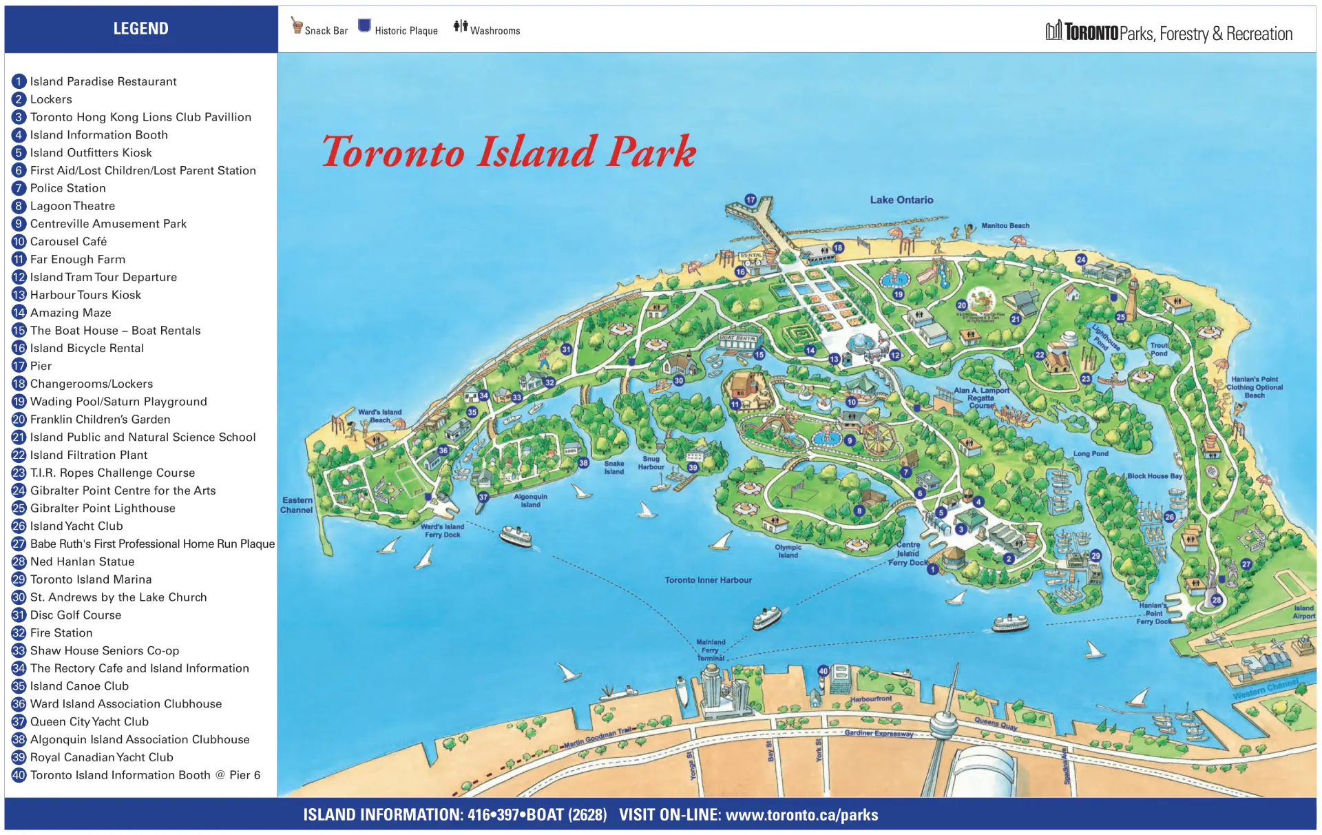
Toronto Island Park Map and Brochure (2025 – 2001)
Spread across a chain of small, ferry-linked islands in Lake Ontario, Toronto Island Park unfolds like a waterfront maze of beaches, trails, and quiet lawns framed by skyline views. Because the park’s layout shifts between lagoons and bridges, a Toronto Island Park map is the key to not wandering in circles when you’re chasing bike rentals, ferry docks, or that perfect picnic spot.
- Location
- Toronto Islands, Toronto, Ontario
- Years Active
- 1858 – Present
- Official Site
- Official Toronto Island Park Site
- Related Maps
- Centreville Amusement Park Map 2026 PDF
It helps pinpoint washrooms, snack bars, Centreville rides, and the best tram routes. Watch for the pinch point near the main pier—it clogs fast after sunset fireworks. Locals swear: the sound of gulls and distant streetcars is pure Toronto calm.
Toronto Island Park Map 2025
In 2025, Toronto Island Park saw the official opening of Biidaasige Park on the new island Ookwemin Minising, which introduced play areas, ziplines, the Badlands Scramble waterplay feature, picnic areas, and a playground with large animal sculptures.
Approximately fifty acres of new parkland debuted, with another ten acres and the Lassonde Art Trail planned for 2026. Centreville Amusement Park also reopened for the season, and City Council began phased operational enhancements guided by the Toronto Island Park Plan.
Printable Toronto Island Park Map PDF 2025
Toronto Island Park Map 2024

Printable Toronto Island Park Map PDF 2024
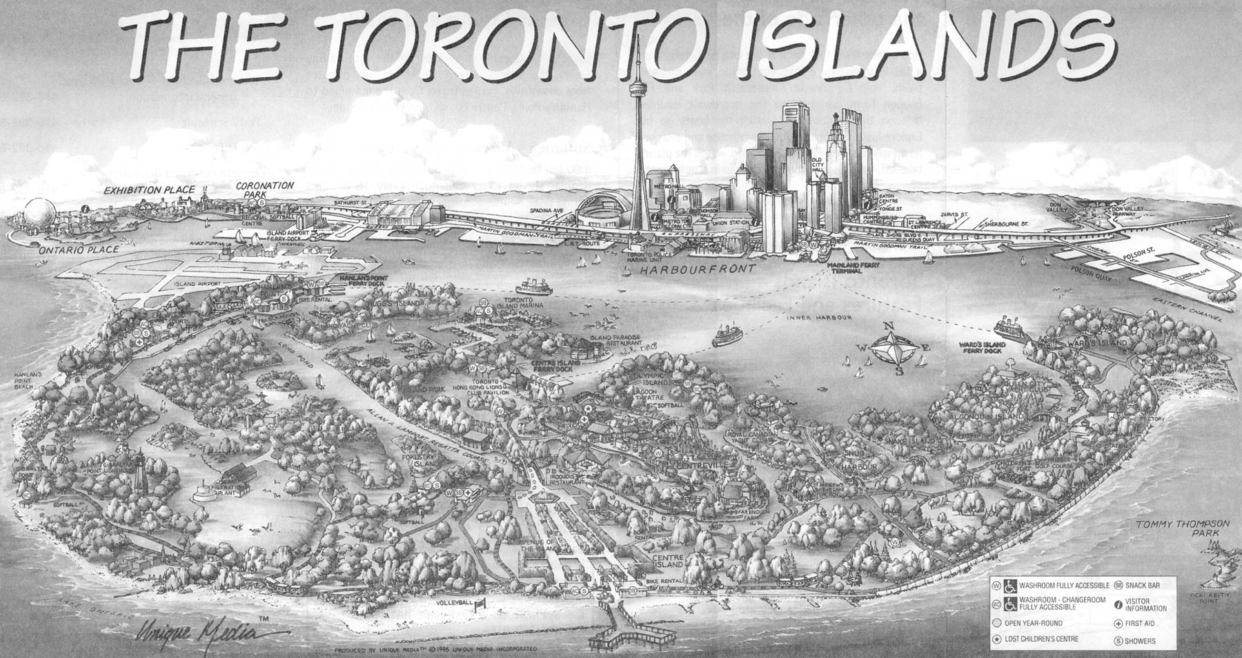
Toronto Island Park Map 2001
FAQ
How long to spend at Toronto Island Park?
You should plan to spend at least half a day to a full day at Toronto Island Park. A short visit of 3–4 hours allows biking and beach time, but a full day lets you explore all three islands, picnic, and relax by the water. Ferry lines and travel times often make a full‑day visit the most enjoyable option.
Are the Toronto Islands worth visiting?
The Toronto Islands are definitely worth visiting for their scenic beauty and variety of activities. Just a 15‑minute ferry ride from downtown, the islands offer beaches, bike trails, gardens, and skyline views in a peaceful, car‑free park. They’re ideal for families, couples, or solo travelers looking for relaxation and recreation within sight of the city.
How do you spend a day on Toronto Island?
Spend a day on Toronto Island by taking the ferry from Jack Layton Ferry Terminal to Centre Island, then biking or walking between Ward’s Island, Centre Island, and Hanlan’s Point. Enjoy beaches, visit Centreville Amusement Park and Far Enough Farm, and see landmarks like Gibraltar Point Lighthouse. Relax with a picnic, explore gardens and boardwalks, and end the day watching the sunset at Hanlan’s Point Beach.
Is Toronto Island Park free?
Toronto Island Park is free to enter and explore. Visitors only need to pay for the ferry ride from downtown Toronto, which costs about CAD $9 for adults and less for children and seniors. Once on the islands, walking, beaches, and gardens are free, while attractions like Centreville rides require separate tickets.