Zealandia Te Māra a Tāne Map (2023 – 2017)
Location: Wellington, New Zealand
Years Active: 1999 – Active
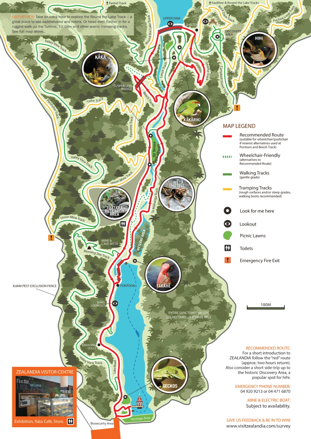
Explore Zealandia Te Māra a Tāne with confidence using the most up-to-date map available. Whether you’re planning to walk the lush Valley Track or visit the renowned sanctuary’s lush ecosystem, this detailed map ensures you’ll easily find every trail, lookout, and discovery point.
With the lush forests and native wildlife around every corner, let this guide help you navigate to must-see spots like the eco-sanctuary’s hidden reservoir and peaceful wetlands.
Zealandia Te Māra a Tāne Map 2023

Printable Zealandia Te Māra a Tāne Map PDF 2023
Zealandia Te Māra a Tāne Map 2020

Zealandia Te Māra a Tāne Map 2017
FAQ
How long is the Zealandia walk?
The Zealandia walk spans about 32 kilometers of trails within the sanctuary. Visitors can explore various routes, with shorter walks taking about 1-2 hours and longer ones lasting the whole day. Some popular trails include the Valley Track and the walk to the upper dam.
Is Zealandia a place?
Yes, Zealandia is an urban ecosanctuary located in Wellington, New Zealand. It’s a fully fenced reserve designed to restore the area to its pre-human state and protect native wildlife.
What is the 500-year plan for Zealandia?
Zealandia’s 500-year plan aims to restore the valley’s ecosystem to its pre-human state. The long-term vision focuses on reintroducing and protecting native species, enhancing biodiversity, and creating a self-sustaining habitat free of invasive predators.